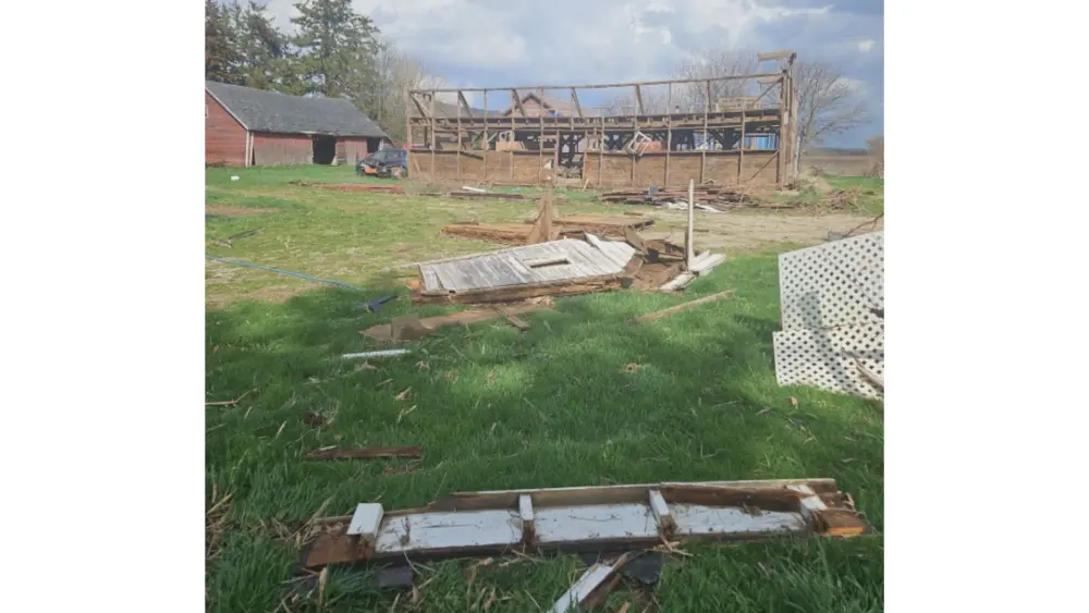
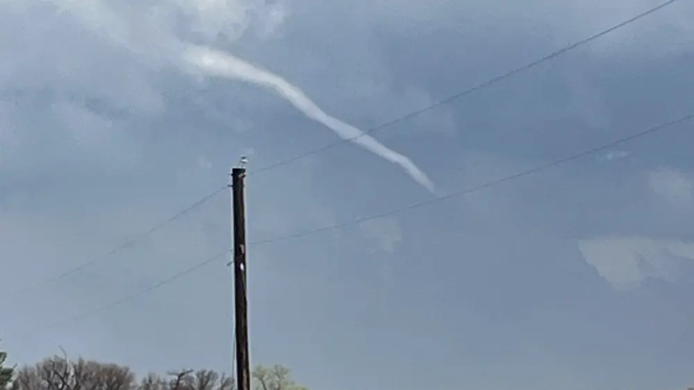
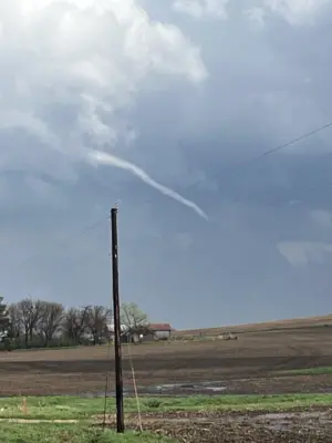
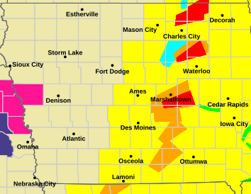
Iowa faced a high-stakes afternoon Friday (4/17/26) as a line of powerful storms swept across the state, triggering multiple tornado warnings. Between 2:00 and 3:30 p.m., radar-indicated rotation prompted immediate shelter orders for residents in Butler, Marshall, and Tama counties. A funnel cloud was specifically spotted near Parkersburg, highlighting the volatility of the system. That funnel did not reach the ground.
Following that volatile week, a sharp cold front has dramatically shifted the region’s weather. The brief taste of spring warmth has been replaced by sub-freezing temperatures, with overnight lows dipping to 30° and daytime highs struggling to break out of the 40s. With a hard freeze expected to persist through the remainder of the weekend, the primary concern has turned to protecting sensitive vegetation. Experts advise keeping plants covered or indoors until these freezing conditions subside and more seasonal weather returns early next week.
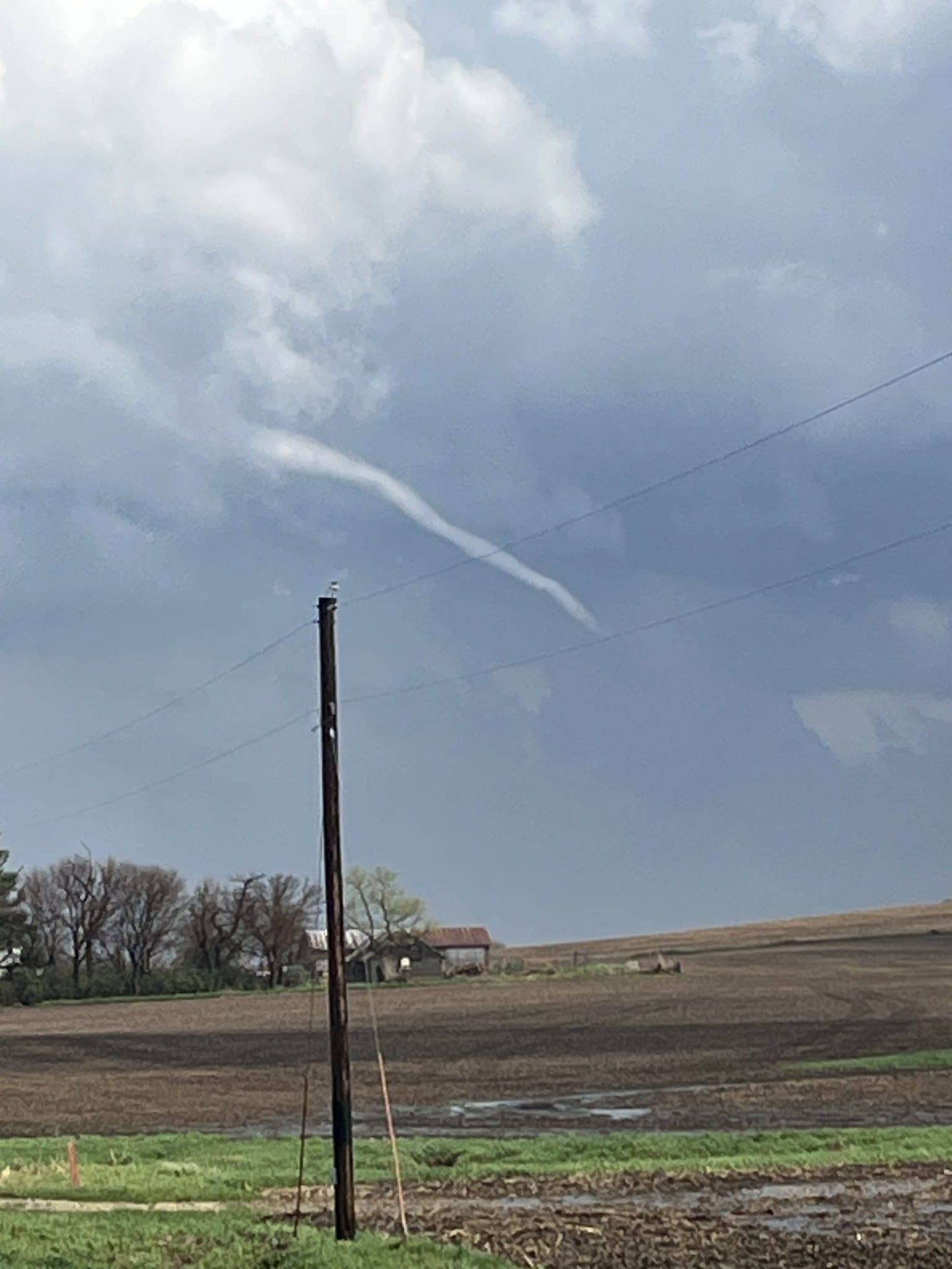
Photo credit: Duane Carstens, OnTheGoMedia